
If you’re anything like me, when I go away, I try to avoid the crowds, not add to them, and this includes hiking. Part of the fun is discovering places nobody else has been to that are often just as beautiful, if not more so, than the big-name hiking trails.
After all, who wants to share those fabulous views with hundreds of tourists? I certainly don’t. So, as wonderful as Yellowstone and the Appalachian Trail are, I want something I can be more at one with nature and not deal with other humans, well, not many of them anyway.
It turns out there are plenty of stunning hiking trails in Europe that are relatively undiscovered. Not the famous ones like the Tour du Mont Blanc or the Camino Francés, but ones you’ll probably have never heard of.
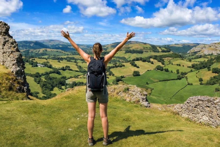
7 Hiking Trails in Europe Away From the Crowds
Trust me, once you’ve read about these 7 hiking trails and seen the pictures, you’ll be pulling on your hiking boots and grabbing your rucksack.
France: Le Chemin du Puy
Everyone’s heard of the Camino de Santiago. Not everyone knows about the French route that feeds into it, which many walkers say is actually more beautiful.
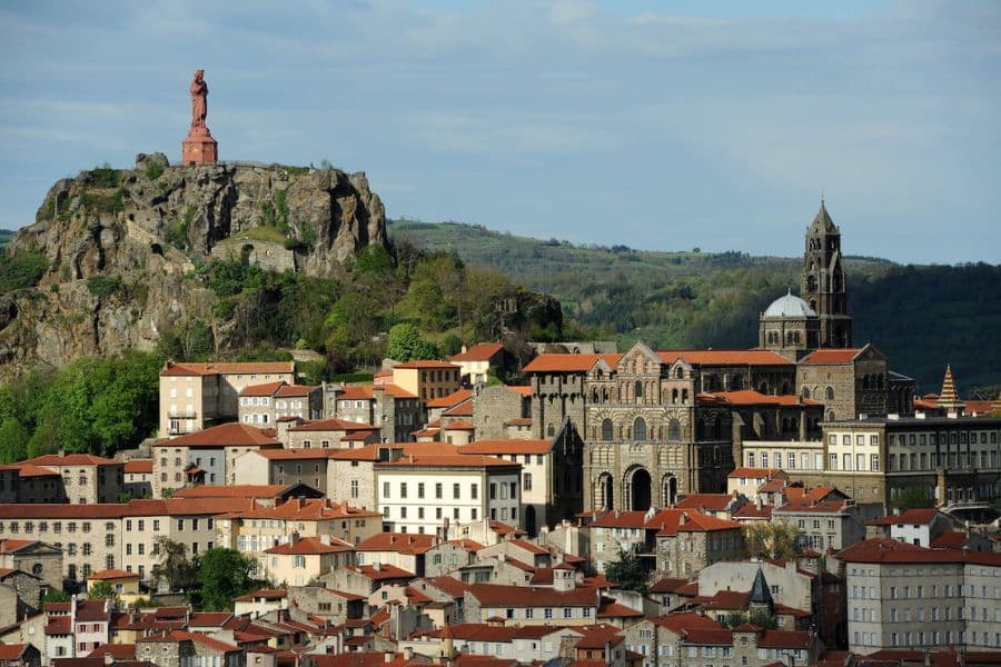
Le Chemin du Puy begins in the volcanic city of Le Puy-en-Velay, where a medieval chapel has been perched atop an 85-meter volcanic rock spike since 961 AD. The trail stretches 736 kilometers through some of France’s most beautiful countryside before connecting with the famous Camino Francés at Saint-Jean-Pied-de-Port in the Pyrenean foothills.
You walk through volcanic plateaus, ancient abbeys, and the medieval village of Conques. You pass through 11 of France’s officially designated most beautiful villages.
Each year, roughly 25,000 to 30,000 people walk this route. Compare that to more than 200,000 on the famous Spanish Camino. Some days, you won’t see another person on the trail at all. One walker described seeing more tractors than people.
You don’t need to walk all 736 kilometers. The first section from Le Puy to Conques, about 10 days, is considered the most spectacular stretch and is fully accessible by train between stages if you want to tackle it in pieces.
Best time to go: April through October. Spring and fall offer the best temperatures.
Scotland: The Lost Valley, Glencoe
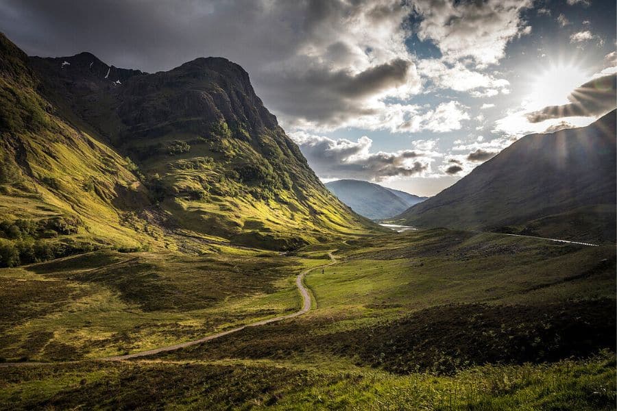
Most people drive through Glencoe, stop at the roadside viewpoint, take a photo of the Three Sisters, and get back in the car. Which is a shame, because the real magic is just a 2.5-mile hike away.
The Lost Valley sits hidden between two of those rocky peaks, and you can’t see it from the road at all. Locals call it Coire Gabhail in Gaelic.
For centuries, the MacDonald clan used it to hide stolen cattle from their neighbors. And then in February 1692, government soldiers who had been living as guests in MacDonald homes for nearly two weeks turned on their hosts in the night and murdered 38 of them. The survivors fled into this valley during a blizzard. It’s one of the darkest stories in Scottish history.
The hike itself involves crossing a river on stepping stones, scrambling up rocky sections, and a bit of hands-on-rock work near the top. The route is about 4km with around 375 meters of ascent and takes 2 to 3 hours depending on your pace.
But when you walk over that final rise and the valley suddenly opens in front of you, flat and wide and completely surrounded by sheer cliff walls, you’ll understand why the MacDonalds chose it. It feels like the rest of the world ceased to exist.
Best time to go: May through September. Avoid after heavy rain when the river crossing becomes dangerous.
England: Offa’s Dyke Path

King Offa of Mercia built one of England’s most mysterious structures in the 8th century. Nobody knows exactly why.
Offa’s Dyke is Britain’s longest ancient monument, stretching 177 miles from Prestatyn in North Wales to Chepstow on the Severn Estuary. Was it a defensive barrier? A show of power? A boundary marker? Historians still argue about it. The dyke itself originally stood around 2.4 meters high and stretched for miles through some of Britain’s most remote countryside.
Walking its route takes you through meadows along the River Wye, rolling hills in Shropshire, and the dramatic Black Mountains. The trail crosses the England-Wales border more than 20 times, so you get two countries for the price of one.
You’ll pass through Hay-on-Wye, a small town with more bookshops per resident than almost anywhere on earth, which I absolutely love, being a complete bookworm. You’ll walk beneath the ruins of Tintern Abbey, which is definitely worth seeing.
The full trail takes around 12 days. You can also tackle it in sections, which makes it perfect for planning a long weekend around a specific stretch.
Best time to go: April through October. The Shropshire Hills section is tougher but wonderfully quiet in shoulder season.
Austria and Switzerland: The Rätikon High Trail
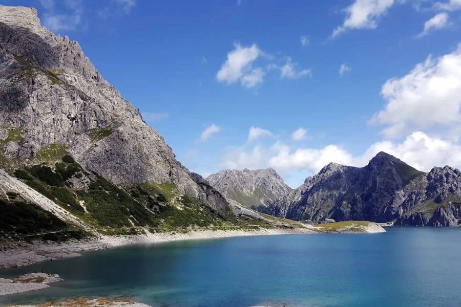
The Rätikon Alps straddle the border between Austria, Switzerland, and Liechtenstein. The 4-day hut-to-hut trail here follows ancient shepherd routes that connected mountain communities for centuries. You walk in the footsteps of people who used these paths for trade and survival long before anyone thought of them as recreation.
On day two, you cross the international border at a dramatic limestone gap in the mountains called the Schweizer Tor. The Swiss Gate. One step and you’ve moved from Austria into Switzerland, with peaks rising on both sides and cowbells echoing off the rock faces.
The trail follows the Swiss-Austrian border between the peaks of Schesaplana and Sulzfluh, climbing to the route’s highest point at 2,239 meters. Each night, you sleep in a mountain hut where someone cooks a proper meal, and you share a table with hikers from across Europe. The highest peak in the range, Schesaplana, reaches 2,964 meters.
Best time to go: July and August for the best trail conditions and open huts.
Switzerland: The Edelweiss Höhbalmen Trail, Zermatt
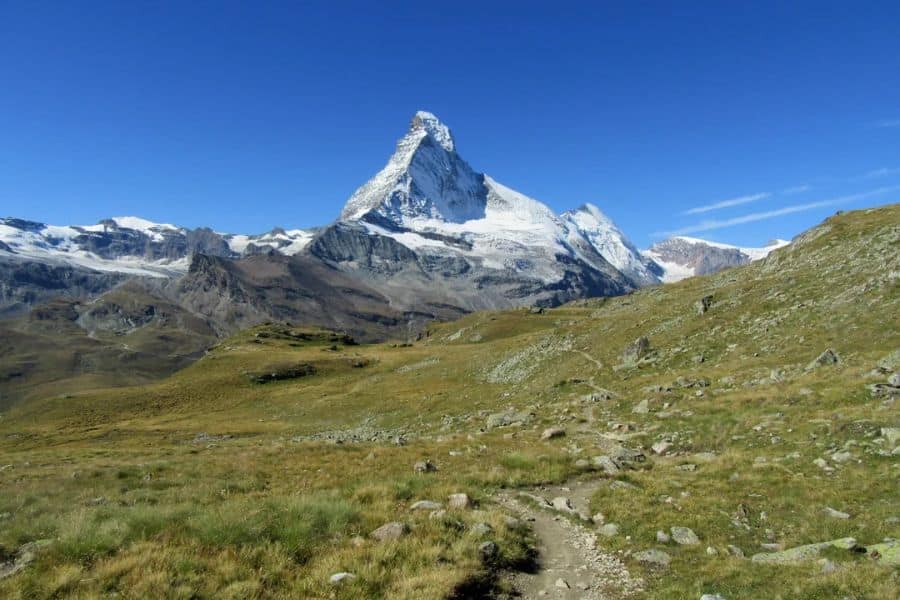
The Höhbalmen Trail is a 21km loop winding through alpine meadows filled with edelweiss, past glaciers, and along rocky ridges where the Matterhorn appears at every turn from angles the postcards never show. In July and August, when the edelweiss flowers are out and the snow has retreated from the lower sections, it’s one of the most beautiful walks in Europe.
The trail sits above the main tourist zone, which means the only people you’ll meet are those who came specifically to hike. The terrain is varied, with some rocky stretches, but nothing that would stop a determined intermediate hiker.
Start early. The afternoon views from the high ridgeline in clear conditions are absolutely breathtaking.
Best time to go: July through September, when the alpine flowers are in bloom and conditions are most stable.
Germany: The Schrammsteine Trail, Saxon Switzerland
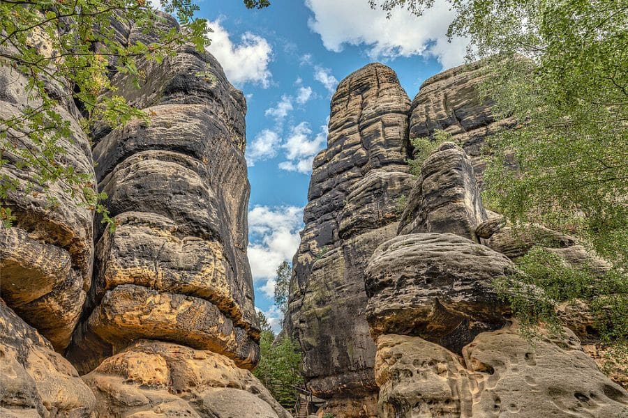
Saxon Switzerland National Park sits about 40 kilometers southeast of Dresden near the Czech border. The name was given by two Swiss artists in the 18th century who explored the area and thought it reminded them of home.
The park is full of massive sandstone towers that jut straight up from dense forest. These formations have been eroding since the Cretaceous period. In 1913, a local guide named Rudolf Fehrmann wrote a code of conduct for climbers that is still respected today. His face is carved into the rock along one of the trails.
The Schrammsteine hike starts near Bad Schandau, accessible by direct train from Dresden in about 40 minutes. You walk through gorges and forests before the trail climbs through iron staircases and ladders bolted directly into the sandstone. At the top, the view stretches for miles over the Elbe River, the national park, and the Czech border beyond.
The park has over 400 kilometers of marked trails, but most visitors cluster around the famous Bastei Bridge. Head to the Schrammsteine and you’ll often have the upper sections almost entirely to yourself.
Best time to go: April through October. Autumn is particularly spectacular when the beech forests turn gold.
Spain: The Picos de Europa
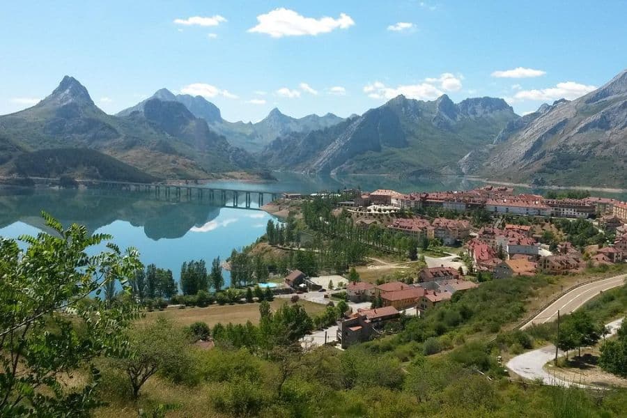
Spain’s first national park, established in 1918, is in the far north of the country and remains one of the least-visited mountain regions in Western Europe. It covers parts of Asturias, Cantabria, and León, packed into a compact area of about 40 kilometers across.
Three limestone massifs rise to peaks above 2,600 meters. Brown bears and wolves still live in the forests here. Local farming communities have been making cheese in these mountains for centuries, using methods that haven’t changed much.
The Ruta de Cares, often called the Divine Throat, is the trail most worth knowing about. Originally built as a maintenance path for a hydroelectric plant and expanded in the late 1940s, it runs 12 kilometers through a narrow gorge between the Western and Central Massifs. The path follows the Cares River, carved into the cliff face hundreds of meters above the water.
Start from Poncebos in Asturias and walk to Caín in León. The trail passes through tunnels, over narrow bridges, and along exposed ledges with sheer drops below. It looks more dramatic than it actually is, though you won’t want to be looking at your phone when you’re on the ledge sections.
Best time to go: May through September. Mid-week in June or early September if you want fewer people on the Cares trail.
Disclaimer: This article is for general information only and is not professional advice. It may contain affiliate links. Please see our full Editorial Policy for details.

Kylie Lang is a nationally syndicated travel journalist with bylines on the Associated Press Wire & more, a lifestyle writer, and the founder and editor of Your Lifestyle Library (yourlifestylelibrary.com). She holds a BA (Honours) in History from the University of Kent and is a member of the British Guild of Travel Writers.