
Every summer, across America’s most famous national parks, the tourists come in their thousands. You wait three hours just to enter Yellowstone, the parking lots at Yosemite fill by 6 a.m., and Rocky Mountain National Park requires timed-entry reservations. And don’t even get me started on trying to find a campsite anywhere near the Grand Canyon without booking at least a year in advance.
Meanwhile, there are mountain ranges across the US where you can hike for miles without seeing another soul. Places with peaks just as dramatic, trails just as spectacular, and views that’ll make your jaw drop, all without the nightmare logistics of visiting America’s most popular parks.
These seven mountain ranges offer everything you love about hiking in the national parks, minus the crowds and minus the stress.
7 US Mountain Ranges to Visit in 2026
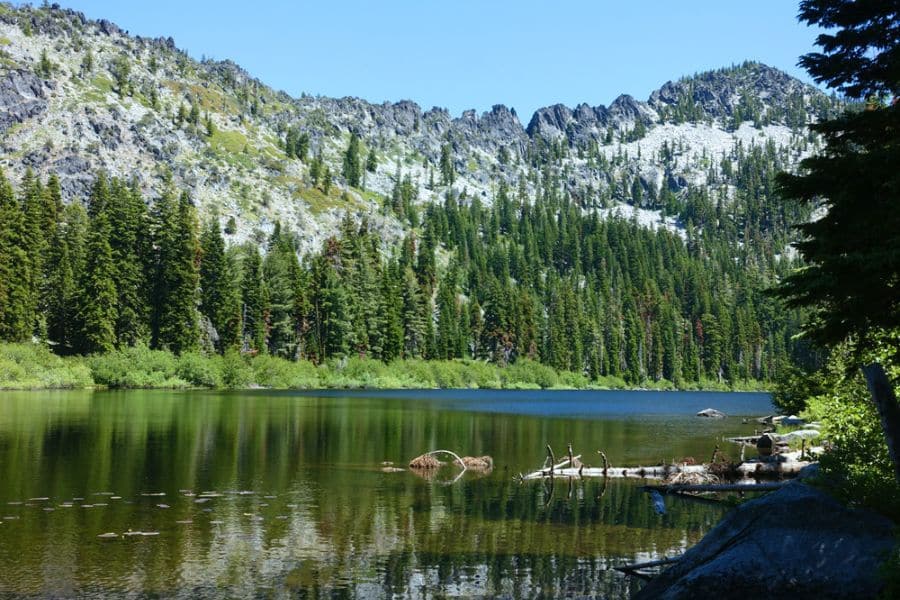
In these seven hiking spots, you’ll get the wilderness experience without the traffic jams and crowds. Instead, you’ll enjoy stunning views, wildlife, lakes, and granite peaks, something you won’t find in the overcrowded US National Parks.
100-Mile Wilderness, Maine
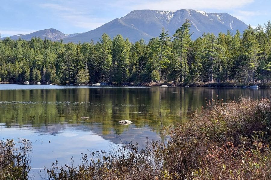
The northernmost section of the Appalachian Trail stretches from Monson to Abol Bridge, 100 miles of pure Maine wilderness. This is the most remote stretch of the entire AT, with roots, rocks, bogs, and mountains.
Most thru-hikers tackle this section last, treating it as the final test before Mount Katahdin. Day hikers and section hikers get lakes like Rainbow and Nahmakanta, peaks like White Cap Mountain, and Gulf Hagas, the Grand Canyon of Maine. The trail cuts through 750,000 acres of forest where cell service doesn’t exist, giving you complete freedom from the outside world.
You’ll cross rivers on logs, climb straight up mountains without gentle grades, and camp at lean-tos scattered along the route. Late summer brings fewer bugs and drier conditions. Come prepared with navigation skills, as trail blazes are minimal and getting lost is a real possibility.
Weather changes fast, and what starts as sunshine can turn into serious storms within hours.
- Where to stay: Monson at the southern end or Millinocket near the northern terminus. Shaw’s Hiker Hostel in Monson provides shuttles, resupply drops, and everything you need for wilderness trips.
- Best time to visit: Late June through September. Early June brings blackflies that’ll make you question your life choices. August means sharing trails with summer camp groups and other hikers.
- Top Tip: Use the Maine Appalachian Trail Club maps, not the AMC version. Arrange a food drop at the Jo-Mary Road halfway point unless you want to carry 10 days of supplies on your back.
Mount Jefferson Wilderness, Oregon
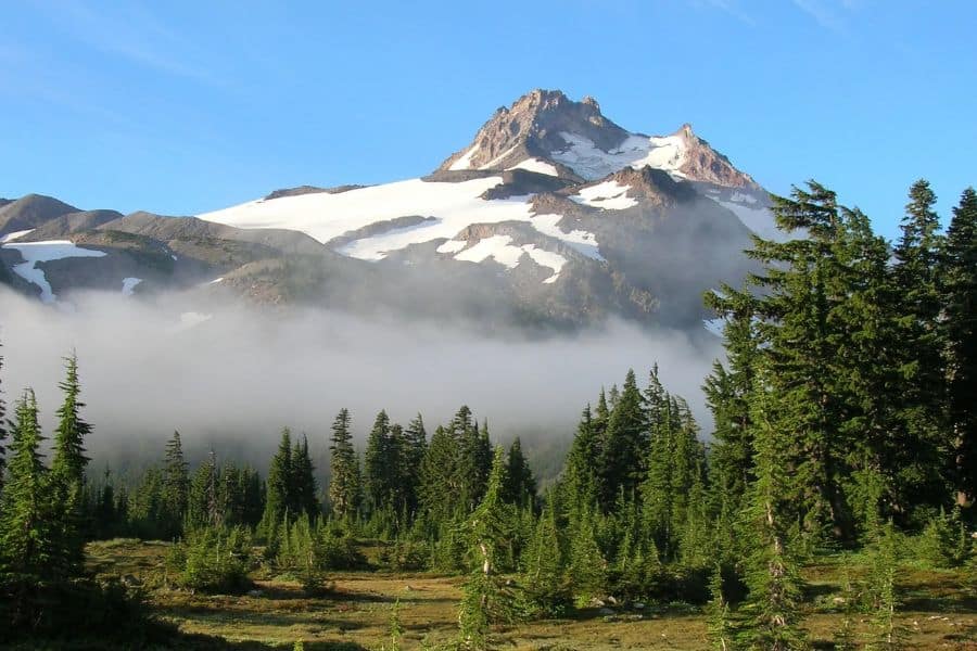
Mount Jefferson rises to 10,497 feet and is covered by five glaciers that carve through the Oregon Cascades. The wilderness protects 109,000 acres of alpine lakes, volcanic peaks, and meadows carpeted with wildflowers in July. Over 150 lakes dot the landscape, most stocked with trout, and the Pacific Crest Trail runs 40 miles through the heart of it all.
Jefferson Park sits in a glacial basin at the mountain’s base, ringed by wildflower meadows and alpine lakes. The Whitewater Glacier feeds streams that cut through the park, and on clear days, you can see from Mount Hood to the Three Sisters. Canyon Creek Meadows offers an easier alternative with alpine scenery minus the elevation gain.
Permits are required from June 15 through October 15 for popular trails such as Pamelia Lake and Jefferson Park. The 2003 B&B Fire burned sections of the wilderness, leaving behind silver snags and new growth that creates a landscape still healing. Some trails remain unmaintained and essentially impassable.
The high country holds snow into July. Come August, huckleberries ripen along the trails, and the crowds thin out. Groups are limited to 12 people, and campfires must stay 100 feet from water.
- Where to stay: Detroit or Sisters for full amenities and easy access to trailheads. Detroit sits on Detroit Lake with restaurants and supplies. Sisters offers more options and sits closer to the eastern trailheads.
- Best time to visit: Mid-July through September for snow-free trails and peak wildflowers. Late September brings fall colors and empty trails.
- Top Tip: Skip the Pamelia Lake permit lottery and take the South Breitenbush Trail into Jefferson Park. Longer approach, better views, almost nobody on the trail.
Russian Wilderness, California
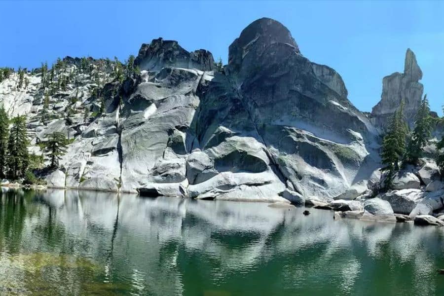
Just 12 miles of granite peaks and alpine lakes tucked into Northern California’s Klamath Mountains, the Russian Wilderness isn’t well known. Russian Peak tops out at 8,196 feet, surrounded by glacially carved basins holding lakes like Big Duck, Little Duck, and Sugar Lake. Seventeen species of conifers grow in the Sugar Lake basin alone.
The wilderness covers just 19,700 acres, making it tiny compared to neighboring Trinity Alps, but the granite formations rival anything in the Sierra Nevada. Trails climb through old-growth forest before breaking into open bowls ringed by serrated ridges. Most lakes sit at elevations between 5,800 and 6,600 feet.
No permits required means true freedom to roam. Nearly 100 miles of trails range from well-maintained routes to steep, barely-used paths where you’ll be clearing deadfall. Some trails are deliberately minimal to preserve the wilderness character.
The area sees snow from November through May. Summer afternoons bring thunderstorms rolling over the peaks. Fall turns the high country gold and red before the first snows arrive in October.
- Where to stay: Etna or Fort Jones provide the closest services, about 25 minutes from the trailheads. Both towns offer basic amenities and that real small-town California feel.
- Best time to visit: Late June through September. July and August bring the warmest weather and best lake swimming.
- Top Tip: The Duck Lakes via Duck Lake Trail gives you the full Russian Wilderness experience in one trip. Granite, alpine lakes, wildflowers, and usually empty campsites at both lakes.
North Cascades National Park, Washington
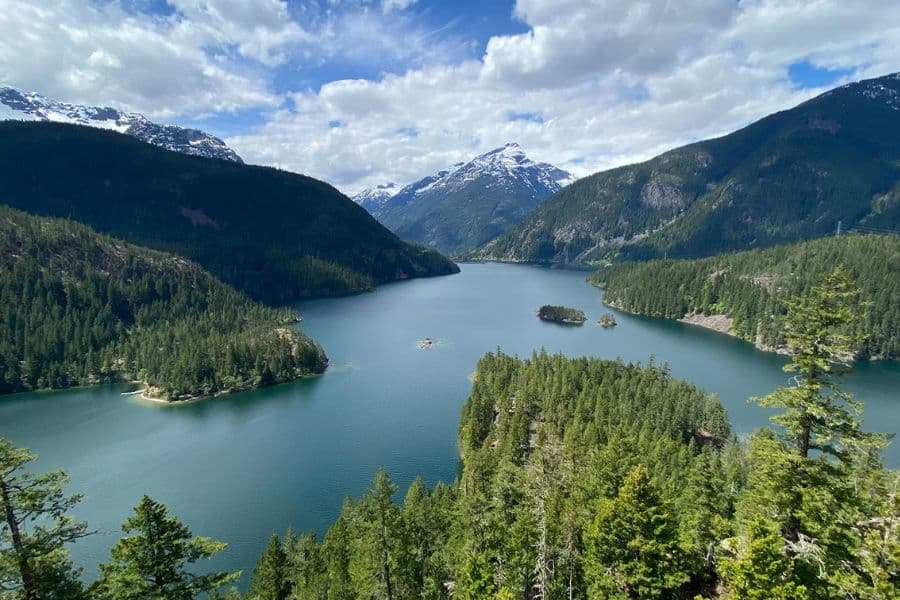
Over 300 glaciers, jagged peaks that earned the nickname American Alps, and fewer visitors than almost any national park in the lower 48. The North Cascades protects some of the most dramatic mountain terrain in America, yet most people drive straight through on Highway 20 without stopping.
The park sees about 40,000 visitors annually compared to Mount Rainier’s two million. This means empty trails, available campsites, and a wonderful solitude you won’t find in national parks. Thunder Knob Trail delivers stunning views of Diablo Lake’s turquoise water in just 3.6 miles.
Cascade Pass ranks as the park’s most popular trail, and even on summer weekends, you’ll see maybe 50 people instead of 500. Push beyond the pass to Sahale Arm, and the crowds disappear entirely. The Stehekin Valley, accessible only by boat or foot, offers trails where you might hike all day without seeing another person.
Most of the park is designated as wilderness, meaning serious backpacking and technical mountaineering. Day hikers stick to accessible trails along Highway 20. The mountains create their own weather, and conditions can change violently within hours.
- Where to stay: Marblemount on the west side or Mazama on the east provides the closest services. Both towns offer lodging, food, and gas before you enter the mountains.
- Best time to visit: July through September for accessible high country. Highway 20 closes in winter, typically from November through April, depending on snowfall.
- Top Tip: Hit Thunder Creek Trail for an easy introduction to the park’s beauty. The first few miles stay relatively flat along the creek before climbing into serious wilderness.
Cranberry Wilderness, West Virginia
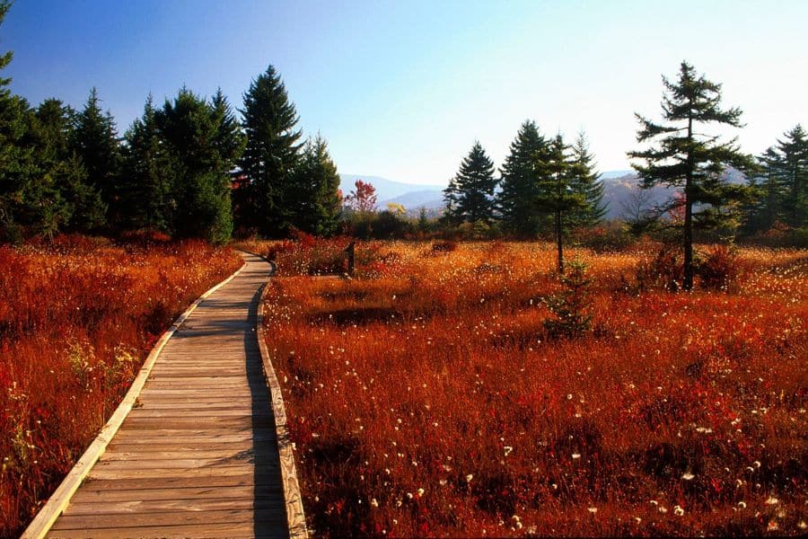
At 47,815 acres, Cranberry Wilderness is the largest Forest Service wilderness in the East. Dense forests of Appalachian hardwoods and red spruce cover mountains that rise from 2,400 to over 4,600 feet. The North Fork of the Cranberry River and Middle Fork of the Williams River cut through the heart of it, creating valleys filled with moss-covered rocks and waterfalls.
This is a designated black bear sanctuary where wildlife outnumbers people. Fifteen interconnected trails cover 75 miles with minimal blazing and no bridges at stream crossings. The North-South Loop makes a classic 18-mile backpacking trip through the wilderness’s best scenery.
Trails follow old railroad grades from early 1900s logging operations. Some sections remain well-maintained, while others become overgrown and difficult to follow. Navigation requires actual map and compass skills, and GPS is highly recommended. Expect to ford streams, climb over deadfall, and bushwhack when trails fade.
The wilderness lives up to its wet reputation. Rain falls regularly, bogs appear along ridgelines, and the entire region feels perpetually damp. Come prepared for water everywhere and trails that double as creek beds.
- Where to stay: Richwood sits closest to the southern access points. Marlinton offers more amenities and easy access to Highland Scenic Highway trailheads.
- Best time to visit: June through October. Spring brings flooding from snowmelt. Fall colors peak in early October before winter weather arrives.
- Top Tip: Register at Cranberry Mountain Nature Center before heading into the wilderness. Download trail maps ahead of time because cell service doesn’t exist once you’re in the mountains.
Lost Creek State Park, Montana
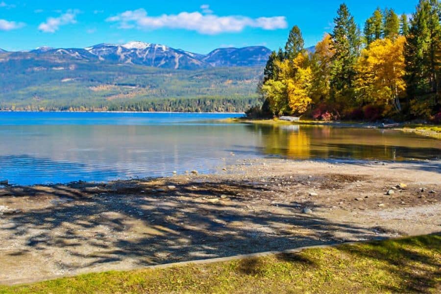
Limestone cliffs and pink granite formations rise 1,200 feet above Lost Creek’s canyon floor. Lost Creek Falls drops 50 feet in the park’s northwest corner, and mountain goats navigate rocky ledges on the canyon walls. The park protects just 502 acres, but connects to Beaverhead-Deerlodge National Forest trails that extend for miles into the mountains.
The main trail follows Lost Creek through forests and meadows with views of surrounding peaks. It’s mostly gentle hiking suitable for families, though you can push farther into the national forest for serious elevation gain and solitude. The Lost Creek to Foster Creek Trail climbs nearly 12 miles with rocky terrain and steep grades.
Twenty-five campsites line the creek, tucked among trees, with the sound of water and the occasional waterfall providing constant background noise. No hookups, no reservations, just basic camping with vault toilets and hand-pumped water. RVs and trailers are limited to 23 feet because the access road gets narrow and rough.
Fall brings aspens turning gold across the canyon. Wildlife viewing peaks in the morning and evening when bighorn sheep, mountain goats, and golden eagles are most active.
- Where to stay: Camp at Lost Creek State Park or stay in Anaconda, six miles south. Anaconda has full services, including the historic Washoe Theatre.
- Best time to visit: May through September. The park becomes inaccessible in October when snow closes access roads.
- Top Tip: Arrive early or midweek for the best campsite selection. The waterfall trail takes just 10 minutes from the parking and makes a perfect leg-stretcher if you’re just passing through.
Guadalupe Mountains National Park, Texas
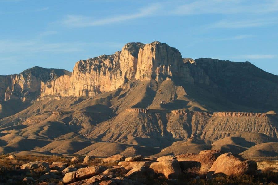
Texas’s highest peak rises to 8,751 feet above the Chihuahuan Desert, surrounded by 80 miles of trails that see fewer than 230,000 visitors annually. The Guadalupe Mountains contain the world’s most extensive Permian fossil reef, ancient marine life preserved in limestone that formed 260 million years ago when this desert sat underwater.
Guadalupe Peak Trail climbs 3,000 feet in 4.2 miles, steep and exposed but straightforward. Most hikers take 6-8 hours for the round trip. Devil’s Hall offers a moderate alternative through a narrow canyon to a rock formation called the Hiker’s Staircase. McKittrick Canyon turns spectacular in fall when bigtooth maples blaze red and gold.
The park is split into five districts. Pine Springs handles most visitors at the main campground and visitor center. Dog Canyon sits remote on the north side, accessible by a long dirt road from New Mexico. McKittrick Canyon requires a separate entry point.
The Guadalupe Mountains rank as the second windiest place in America, with gusts regularly topping 30-40 mph. Weather changes fast, temperatures swing wildly, and water sources are basically nonexistent on trails.
- Where to stay: Pine Springs Campground offers 20 RV sites and 19 tent sites. The nearest town with services is Van Horn, 65 miles south, or Carlsbad, New Mexico, 55 miles north.
- Best time to visit: March, April, and October for mild temperatures. Summer brings extreme heat. Winter can dump snow on high peaks while the desert stays clear.
- Top Tip: Carry way more water than you think you need. One liter per two hours minimum, and double that for Guadalupe Peak. The closest gas station sits 35 miles away, so fill up before entering the park.
Disclaimer: This article is for general information only and is not professional advice. It may contain affiliate links. Please see our full Editorial Policy for details.

Kylie Lang is a nationally syndicated travel journalist with bylines on the Associated Press Wire & more, a lifestyle writer, and the founder and editor of Your Lifestyle Library (yourlifestylelibrary.com). She holds a BA (Honours) in History from the University of Kent and is a member of the British Guild of Travel Writers.