
There’s nothing quite like the feeling of stumbling across a hidden trail that looks as though it’s never been discovered by others. You feel as though you’re unwrapping a gift from nature. The breathtaking views, stunning scenery, and amazing colors stop you in your tracks.
Most hikers know about Yosemite and the Appalachian Trail. They’ve seen the Grand Canyon from the rim and walked among the redwoods. But some of America’s most spectacular trails are hidden in plain sight, waiting for you, full of raw natural beauty.
So get your boots ready, as we’re about to embark on a voyage of discovery to find America’s best-kept hiking secrets. You’re about to go to places you’ve never been before.
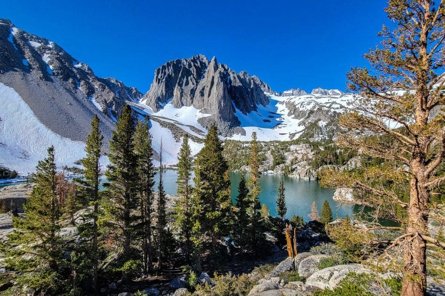
7 of America’s Best-Kept Hiking Secrets to Explore
These trails will test your limits in the best possible way. Each one offers something completely different from the others, taking you through landscapes and national parks you probably didn’t know existed in America.
No. 1 Ice Lakes Trail, Colorado
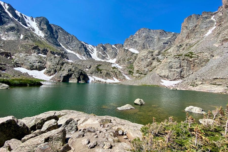
Colorado’s San Juan Mountains are home to the Ice Lakes Trail, which climbs through wildflower meadows and beneath jagged peaks to reach what might be the most impossibly blue alpine lakes in the entire state. The turquoise water sits at over 12,000 feet, surrounded by 13,000-foot peaks that tower overhead like ancient sentinels.
You’ll climb through forests that open into the Lower Ice Lake Basin around mile 2.2, where the views of Fuller Peak and Vermillion Peak are beautiful. But the best is yet to come when you push through that final steep headwall to reach the upper basin.
Ice Lake looks ethereal. It glows with an otherworldly blue-green color that photographs can’t quite capture. The area experienced wildfire damage in 2020, but nature is already reclaiming the burn scars with new growth.
Ice Lakes Hiking Tips:
- Difficulty: Strenuous
- Distance: 7 to 9 miles round-trip
- Time to Complete: 6 to 8 hours
- When to Visit: July through September, afterthe snow melts and before winter closes the road
Where to Base Yourself:
Stay in Silverton, a historic mining town about 15 minutes from the trailhead. The town sits at 9,300 feet, which helps with acclimatization before you tackle the trail. Ouray lies 20 miles north with more lodging options and the famous hot springs for soaking sore muscles after your hike.
Where to stay in Silverton >>>
No. 2 Enchanted Valley Trail, Washington
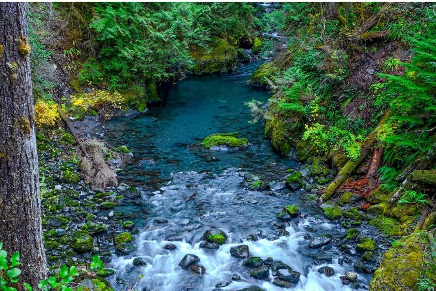
Olympic National Park’s Enchanted Valley follows the East Fork Quinault River through some of the most spectacular temperate rainforest in the Pacific Northwest before opening into a massive glacial valley where waterfalls literally pour from the sky. The historic Enchanted Valley Chalet sits at the trail’s end, a 1930s mountain retreat now listed on the National Register of Historic Places.
The 13.2-mile trail through ancient cedar and spruce forests is stunning. Moss drapes from every branch, the river roars beside you, and the forest floor disappears under ferns that reach your waist. Around 2.5 miles in, you’ll cross Pony Bridge over a moss-covered gorge that could be out of Middle Earth.
When you finally emerge into Enchanted Valley itself, you will catch your breath. Waterfalls cascade down 3,000-foot cliff walls in every direction, especially spectacular in spring when snowmelt turns every rock face into a streaming ribbon of white water. Black bears live in the valley, and you’ll likely spot Roosevelt elk grazing in the meadows.
Enchanted Valley Hiking Tips:
- Difficulty: Moderate
- Distance: 26 miles round-trip
- Time to Complete: 2 to 3 days for backpacking, extremely strenuous as a day hike
- When to Visit: Late June through September, though May and October offer solitude if you’re prepared for unpredictable weather
Where to Base Yourself:
Lake Quinault sits about an hour from the trailhead with several lodges and the historic Lake Quinault Lodge. Amanda Park has basic services and puts you 30 minutes closer. Most hikers backpack to one of the four established campsites along the trail, with overnight permits required from Olympic National Park.
Where to stay in Lake Quinault >>>
No. 3 Big Pine Lakes Trail, California

The Eastern Sierra is home to Big Pine Lakes Trail, which climbs into the John Muir Wilderness where seven alpine lakes sit beneath the Sierra’s highest peaks, their water colored a gorgeous shade of turquoise by glacial flour from the Palisade Glacier. Temple Crag rises 13,000 feet behind Second Lake, creating one of those views that makes you understand why people obsess over mountain photography.
The trail starts at nearly 8,000 feet and climbs steadily through pine forest before emerging above treeline around mile 2. You’ll pass Lon Chaney’s stone cabin, a 1920s retreat built for the silent film star, before the real climbing begins. First Lake appears around mile 4.5, but most hikers push on to Second Lake, where the full glory of Temple Crag dominates the scene.
The turquoise color intensifies at the upper lakes, fed by streams of milky glacial runoff. On clear days, you can see Kings Canyon National Park on the other side of the peaks. This is high country hiking at its finest, where the air is thin, and the landscape feels ancient.
Big Pine Lakes Hiking Tips:
- Difficulty: Strenuous
- Distance: 9.5 miles round-trip to Second Lake, 15 miles to all seven lakes
- Time to Complete: 6 to 9 hours for Second Lake, full day or overnight for the upper lakes
- When to Visit: June through October, with July and August offering the warmest water for those brave enough to swim
Where to Base Yourself:
Big Pine is the closest town, about 15 minutes from the trailhead. Bishop sits 25 miles south with far more services, including gear shops, restaurants, and lodging. Upper Sage Flat Campground sits just one mile from the trailhead, perfect for an early start. Overnight wilderness permits are extremely limited, so book six months in advance or try for walk-up permits.
Where to stay for Big Pine Lakes >>>
No. 4 Eagle Creek to Tunnel Falls, Oregon
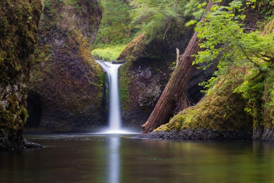
Oregon’s Columbia River Gorge nearly lost this trail to wildfire in 2017. Still, after years of restoration work, the Eagle Creek Trail reopened to show hikers one of the most waterfall-dense canyons in America. The trail was blasted from cliff faces in the 1910s by Italian engineers, creating a route that crosses dizzying gorges and even tunnels behind a 172-foot waterfall. This is adventure hiking at its absolute best.
The trail follows Eagle Creek upstream, passing Metlako Falls, Punch Bowl Falls, and countless smaller cascades before reaching the main event at mile 6. Tunnel Falls drops over a cliff while the trail cuts directly behind it through a tunnel carved from solid rock. Water curtains the entrance, and the sound is overwhelming. High Bridge spans a slot canyon where you can look down into the churning water far below.
Eagle Creek Hiking Tips:
- Difficulty: Strenuous
- Distance: 12 miles round-trip
- Time to Complete: 6 to 7 hours
- When to Visit: Year-round access, but spring runoff makes waterfalls spectacular while summer offers the most stable trail conditions
Where to Base Yourself:
Cascade Locks sits 5 miles from the trailhead with hotels and restaurants. Hood River offers more options 20 miles east, plus excellent restaurants and breweries. Portland lies 45 minutes west, making this an easy day trip from the city. A Northwest Forest Pass costs 5 dollars and is required to park at the trailhead.
Where to stay for Eagle Creek to Tunnel Falls >>>
No. 5 Valley of Fire Wave Trail, Nevada
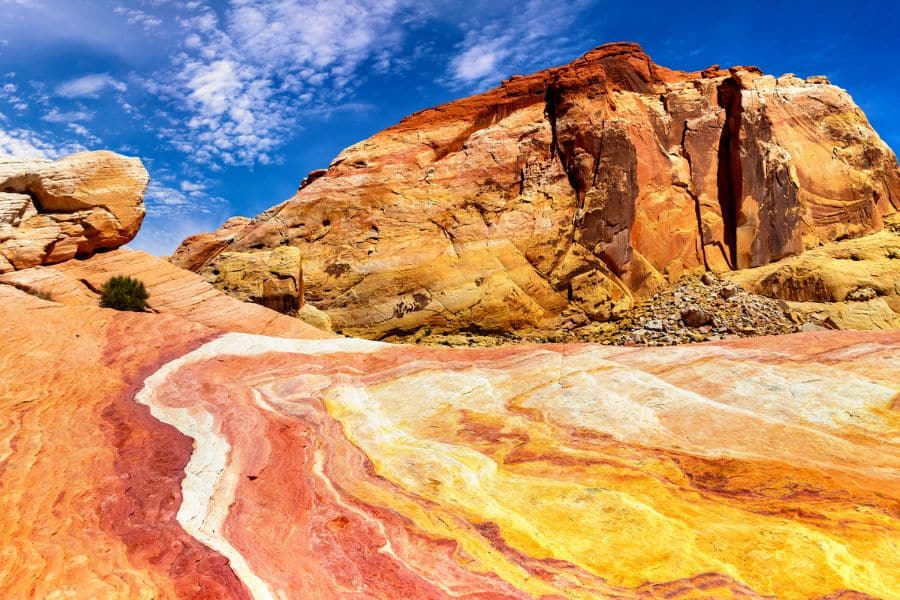
The Fire Wave Trail leads through Valley of Fire’s dramatic red-rock landscape to a sandstone formation where nature painted stripes of red, pink, white, and orange across the slickrock in undulating patterns that look like frozen ocean waves.
The trail starts across sandy desert before transitioning to solid sandstone. Gibraltar Rock towers to one side, its red walls glowing in the afternoon light. Around mile 0.7, the striped sandstone appears, and suddenly you’re walking across geological artwork that took millions of years to create.
The Wave itself sits in a bowl-shaped depression where the color bands intensify. Red and white layers curve across the rock in patterns that shift as you change perspective. The late afternoon light makes the colors practically glow. Unlike Arizona’s Wave, you can visit any day without winning a lottery, making this one of the best geological bargains in the Southwest.
Valley of Fire Wave Hiking Tips:
- Difficulty: Easy
- Distance: 1.3 miles round-trip
- Time to Complete: 1 hour, though you’ll want longer for photography
- When to Visit: October through April to avoid the brutal summer heat that regularly exceeds 110 degrees
Where to Base Yourself:
Las Vegas sits just 55 miles southwest, making this an easy day trip from the Strip. Overton lies 20 miles from the park with basic services. The park itself has two campgrounds if you want to catch sunrise or sunset at the Wave. Entry costs 15 dollars per vehicle, and parking at Lot 3 on White Domes Road puts you right at the trailhead.
No. 6 Devil’s Bathtub Trail, Virginia
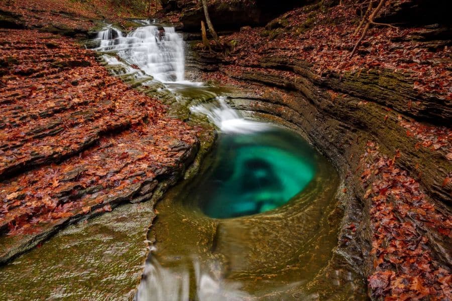
Southwest Virginia’s Devil’s Bathtub has gone from local secret to viral sensation, and one look at the crystal-clear emerald pool carved into solid rock explains why. The trail through Jefferson National Forest crosses the creek over a dozen times, scrambles over boulders, and leads deeper into mountain wilderness before revealing a natural swimming hole that looks too perfect to be real.
The trail follows Devil’s Fork Creek upstream through lush forest where rhododendron creates natural tunnels over the path. You’ll cross the creek at least 15 times, hopping rocks and sometimes wading through the cold mountain water.
Around mile 1.8, you’ll reach a larger pool with a rope swing that many mistake for the main attraction. Keep going another few hundred feet to find the actual Devil’s Bathtub, a bean-shaped depression about 20 feet long, carved perfectly into sandstone. A small waterfall pours in like a natural faucet. The water is so clear you can see straight to the bottom, and so cold it’ll take your breath away when you jump in.
Devil’s Bathtub Hiking Tips:
- Difficulty: Moderate
- Distance: 3.9 miles round-trip
- Time to Complete: 2 to 4 hours, depending on water levels
- When to Visit: May through September, avoiding periods of heavy rain when creek crossings become dangerous
Where to Base Yourself:
Fort Blackmore and Duffield are the nearest towns with limited services. Bristol, Tennessee, lies about 45 minutes away with hotels and restaurants. Most visitors day hike from there or from Kingsport. The parking situation is challenging, with a new county lot adding about 1 mile each way to your hike. Arrive before 9 AM on weekends to avoid parking nightmares and crowds at the swimming hole.
Where to stay for Devil’s Bathtub >>>
No. 7 Plateau Point Trail, Arizona
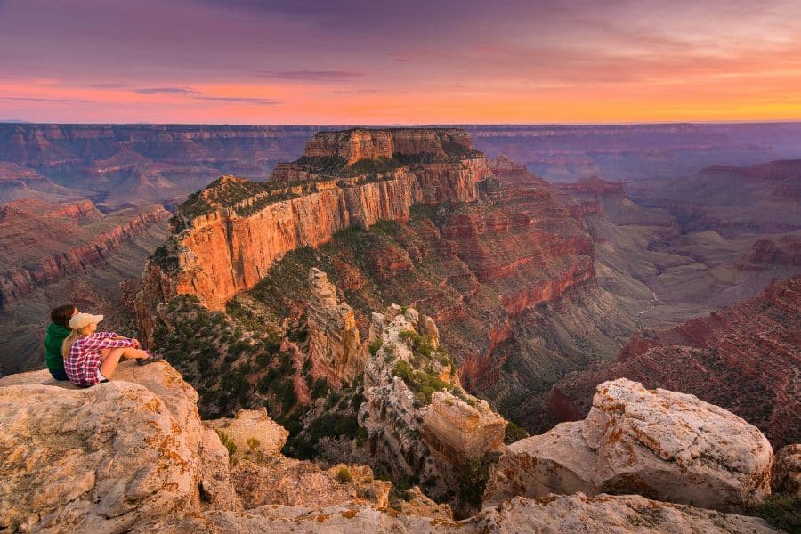
Everyone sees the Grand Canyon from the rim, snapping photos and marveling at the vastness. But hiking down the Bright Angel Trail to Plateau Point takes you into the canyon itself, where you’re surrounded by billion-year-old rock and can look straight down at the Colorado River carving the earth. This is the Grand Canyon experienced from inside rather than above.
The Bright Angel Trail drops 3,080 feet over 4.6 miles through geological layers spanning nearly two billion years of Earth’s history. The trail was created in the early 1900s, creating a route that descends through tunnel after tunnel of Coconino sandstone before opening to wider views. Rest houses at 1.5 miles and 3 miles offer shade and water, and Indian Garden at mile 4.5 sits in a gorgeous green oasis, with cottonwoods providing shade.
From Indian Garden, the flat Plateau Point Trail crosses the Tonto Platform for 1.5 miles to reach the viewpoint. The landscape here is exposed rock and sparse desert plants with the inner gorge dropping away ahead. At the point itself, you stand on a fin of rock with 360-degree views. The Colorado River churns through rapids 1,300 feet below, and the canyon walls tower thousands of feet above.
Plateau Point Hiking Tips:
- Difficulty: Very Strenuous
- Distance: 12 miles round-trip
- Time to Complete: 9 to 12 hours
- When to Visit: Spring and fall offer the best temperatures. Summer heat in the inner canyon regularly exceeds 110 degrees. Winter brings ice to the upper switchbacks, requiring microspikes.
Where to Base Yourself:
Grand Canyon Village on the South Rim provides immediate access to the trailhead with multiple lodging options from Bright Angel Lodge to El Tovar Hotel. Tusayan sits 7 miles south with additional hotels.
Free shuttle buses run from the visitor center to the trailhead. Mather Campground offers camping within walking distance. The National Park Service strongly discourages hiking to the river and back in one day.
Where to stay in the Grand Canyon Village >>>
Disclaimer: This article is for general information only and is not professional advice. It may contain affiliate links. Please see our full Editorial Policy for details.

Kylie Lang is a nationally syndicated travel journalist with bylines on the Associated Press Wire & more, a lifestyle writer, and the founder and editor of Your Lifestyle Library (yourlifestylelibrary.com). She holds a BA (Honours) in History from the University of Kent and is a member of the British Guild of Travel Writers.